|
DAFSAM & NELSAM sponsors |

|

|

|

|

|
The physics of earthquake
processes has remained enigmatic in spite of major advances during the
last few decades. One major obstacle in earthquake investigations is the
lack of direct and near-field observations that are essential for the validation
of models and concepts. The NELSAM project will significantly reduce this
limitation by investigating seismogenic processes at focal depths of earthquakes
in deep gold mines of South Africa. The deep mine setting offers unique
advantages.
First, mining operations control the location, magnitude
and timing of the earthquakes, and the investigation can be focused at
sites where earthquakes of interest are guaranteed to occur.
Second, we will use mine accessibility to observe
earthquake processes within the source region and install a variety of
instruments in a three-dimensional array at distances of 1-100 m from anticipated
hypocenters to monitor fault activity before, during, and after an earthquake.
Third, we will obtain close up observations of earthquakes
in the moment-magnitude range from 2 to perhaps as large as 4, which will
bridge the scale gap between laboratory experiments and tectonic earthquakes
in the crust.
Fourth, this project will provide the first opportunity
to investigate the potential effects of catastrophic fracturing during
earthquakes on the subsurface microbiological communities and fault fluid
and gas chemistry.
We refer to this project as
NELSAM: Natural Earthquake Laboratory in South African Mines.
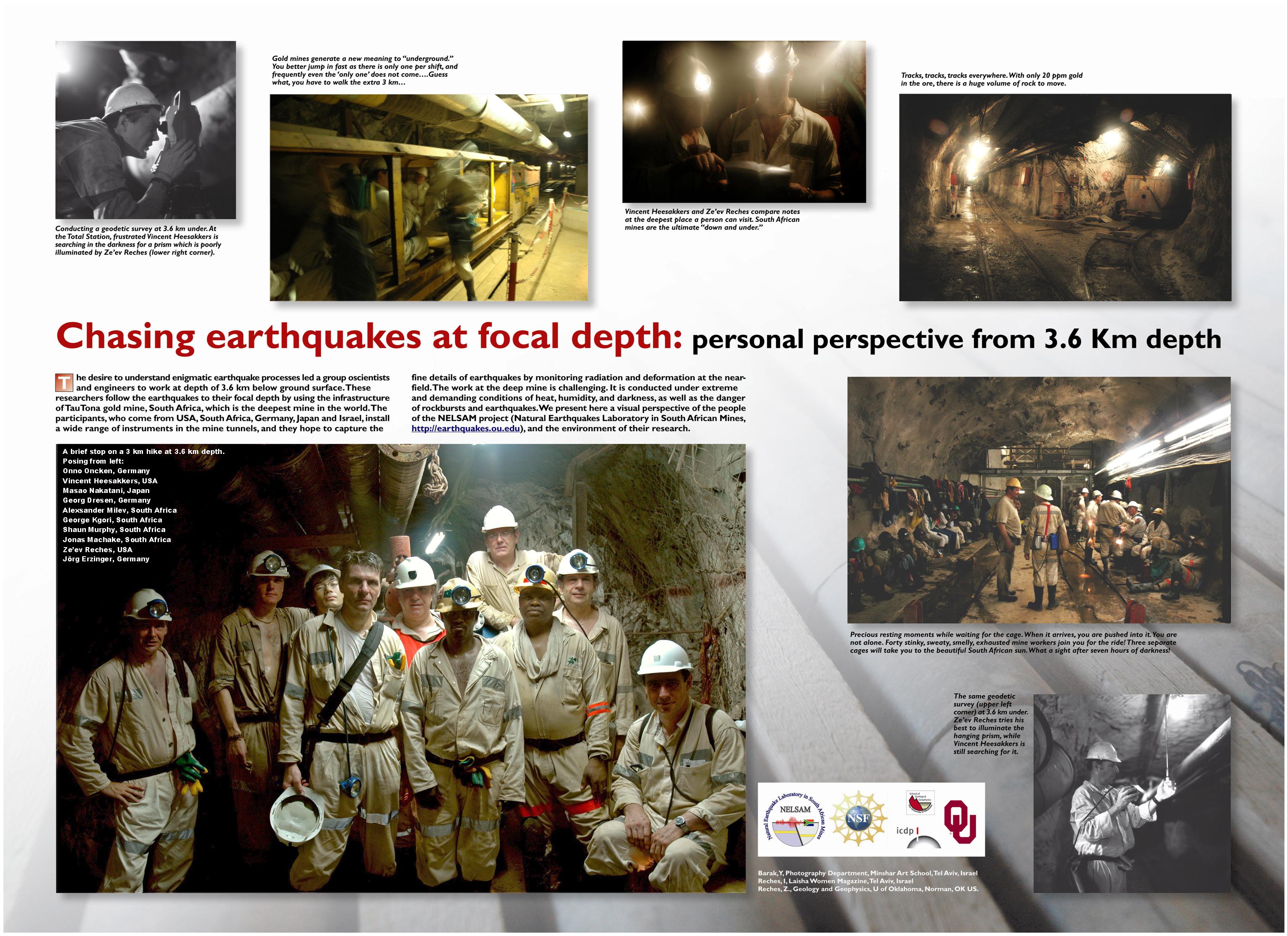
DRILLING SITE WITHIN THE PRETORIUS FAULT ZONE, TAUTONA MINE
The main drilling site of DAFSAM-NELSAM
at 118 crosscut in Tautona mine, Western Deep, South Africa. The
site is located within the Pretorius fault-zone.
| Panorama of northward view into the tunnel (right) and the travel-way (left) at depth of 3472 m below ground surface. ( click for high resolution , photo by Hiroshi Ogasawara). | 
|
|
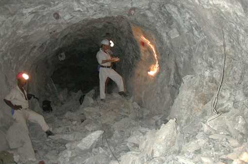
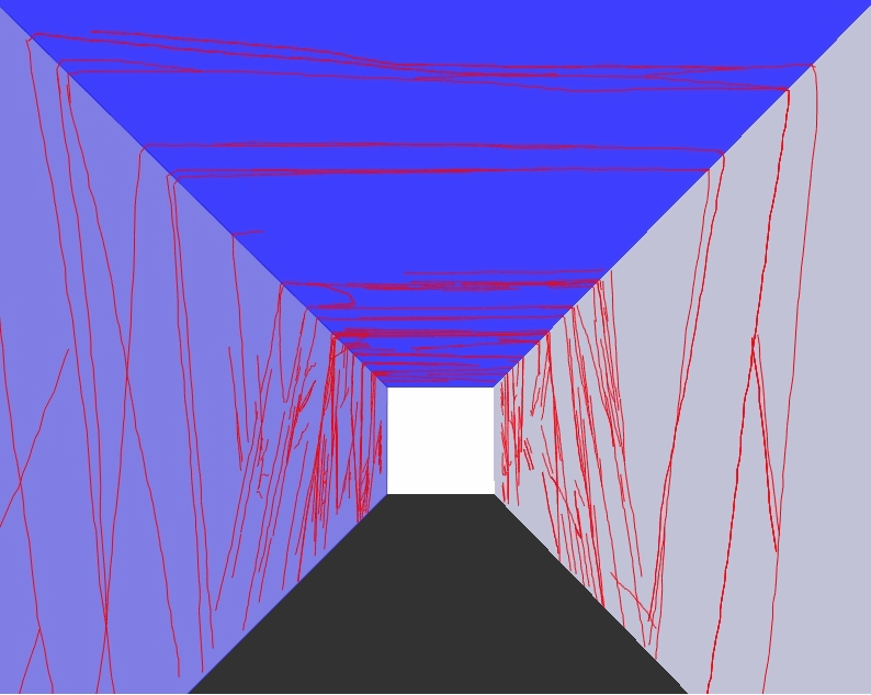
Three-dimensional trip into the Pretorius fault-zone in the drilling
site of 118 crosscut tunnel (dark, horizontal tunnel on the right side of
the panorama). The faults and bedding surfaces were mapped at 1:100 scale
(red lines) along the tunnel covering almost the entire fault-zone of the
Pretorius fault. In this animation you walk northward (and retreat southward)
along 27 m of the fault-zone with brief views to the left and right. Note
that most of the faults are inclined to the south, some incined to the north.
About 1/3 of these faults carry pseudotachyllites. Created with
Jdi
, the visualisation program of ISSI
. |
|
|
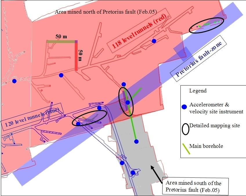
The NELSAM site in Tautona mine is located in the 118 (pink lines) and
120 (blue lines) levels, namely at depth of about 3,600 m below the surface.
The site is centered on the Pretorius fault-zone (light blue zone in NE direction)
where it is intersected by the new development of Tautona mine. In this
area, the region north of the fault is already mined (pink) and a small
portion south of the fault is mined (gray). The future mining in eastward
and westward directions in the block south of the Pretorius fault, "promises"ÂÂ
many earthqukes along the fault zone. The red scale bar points
south. |
|
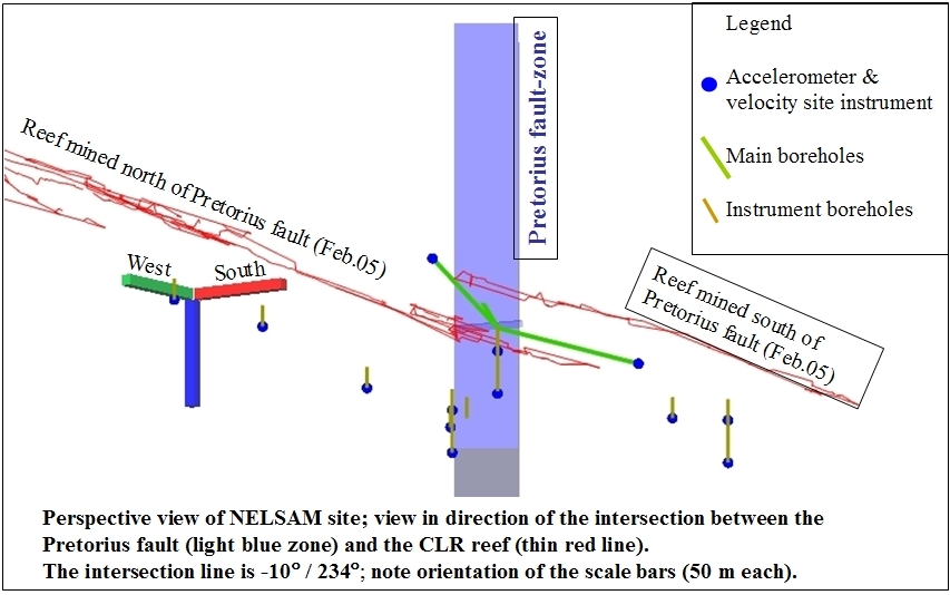
| Perspective view of NELSAM
site; view in direction of the intersection between the Pretorius fault
(light blue zone) and the CLR reef (thin red line). The intersection
line is 10 degrees upward to N054E. |
|